Bridging the Gap: The Essential Guide to Meyers Gazetteer and Arcanum Maps
Overview: The Two Keys to German-Prussian Research
The greatest challenge in German and Prussian genealogy is converting the historical German place name (the Heimatort) into the modern administrative district required to contact an archive.
You must move beyond the vague name to find the specific Standesamt (Civil Registry Office) and the Parish location that actually held the records.
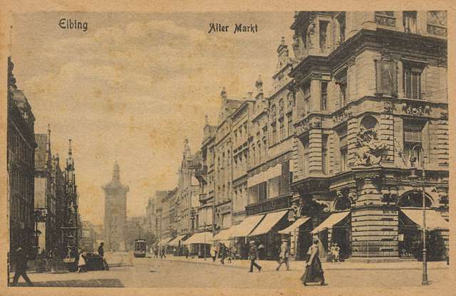 Elbing, Ostpreußen Alter Markt ~ 1890
This tutorial focuses on using the two most critical online tools together:
- Meyers Orts- und Verkehrs-Lexikon des Deutschen Reiches (Meyers Gazetteer): The text-based administrative guide for the German Empire (1871–1918).
- Arcanum Maps (Second Survey): The visual tool that overlays 19th-century maps onto modern satellite imagery.
Part I: Mastering the Meyers Gazetteer
The Meyers Gazetteer is the authoritative directory, listing every known place in the German Empire. Its online version is searchable but requires understanding its shorthand.
The Goal: Identify the Administrative Hubs
For any given village (Dorf), you need to find the location of its two official hubs:
- The Standesamt (StA): Where civil records (births, marriages, deaths after October 1, 1874) were kept.
- The Kirche (Church): Where church records (Kirchenbücher) were kept (records before 1874, separated by denomination).
Interpreting a Meyers Gazetteer Entry
A typical entry for a small village, like Schönthal in East Prussia, might look like this (simplified here for clarity):
Schönthal (Dorf. Ksp. Lichtenhagen (ev.), Ksp. Zinten (kath.), StA Zinten, VfD Preußisch Eylau, Kr. Preußisch Eylau)
The full entry identifies two different parishes (one Evangelical, one Catholic), which is critical information for research.
| Abbreviation | German Meaning | What it Tells You | Actionable Next Step |
|---|---|---|---|
| Ksp. | Kirchspiel (Parish) | The village belonged to the Lichtenhagen Parish for Evangelical (ev.) Church Records. | Search for Lichtenhagen church records (likely in the EZAB or an online collection). |
| Ksp. | Kirchspiel (Parish) | The village belonged to the Zinten Parish for Catholic (kath.) Church Records. | Search for Zinten church records. |
| StA | Standesamt (Civil Registry) | Civil records were filed at the Zinten Civil Registry Office (for events after 1874). | Search for Zinten civil records (likely in the Polish State Archives). |
| Kr. | Kreis (District) | The village was located in the Preußisch Eylau district. | This provides the wider geographical context for archival searches. |
Common Abbreviations to Know
- Kr.: Kreis (District/County) – The central administrative unit.
- A.: Amt (Administrative Office)
- ev.: evangelisch (Evangelical/Lutheran)
- kath.: katholisch (Catholic)
- Ksp.: Kirchspiel (Parish)
- StA: Standesamt (Civil Registry Office)
- E. (or Bf.): Eisenbahn (Railway) / Bahnhof (Train Station) – The nearest train station, helpful for logistics.
- Kgl.: Königlich (Royal) – Denotes a King's institution.
- Lag.: Lager (Camp/Storehouse)
Pro Tip: Always search for the Dorf (village) first, as its entry will contain all the necessary Standesamt and Kirchspiel locations, which are often in larger, neighboring towns.
Part II: Visualizing the Heimatort with Arcanum Maps
While Meyers Gazetteer gives you the names, Arcanum's Second Survey Maps give you the crucial geographical confirmation, allowing you to see the landscape your ancestors knew.
What is the Second Survey?
The Second Survey (Zweite Landesaufnahme) refers to the highly detailed, large-scale topographic mapping projects conducted across the Austrian and German Empires in the late 19th century. These maps are invaluable because:
- They use the original German/Prussian place names (before Polonization or Russification).
- They show every house, path, forest, and body of water, providing incredible detail about the Heimatort.
Using the Arcanum Synchronous Map Feature
The true power of this site is the ability to view the past and present simultaneously.
- Select the Map Layer: On the Arcanum site, select the historical map layer relevant to your area (e.g., the "Europe 19th Century Second Survey" or "Preussische Urmesstischblätter").
- Locate Your Kreis: Navigate the historical map to the Kreis (district) identified in the Meyers Gazetteer.
- Synchronize with Modern View: Use the "Synchronous" feature to drag the slider or opacity tool. This allows you to:
- Confirm Location: Visually confirm the Dorf name on the historical map.
- Find Modern Name: Slide the transparency over to see the corresponding modern Polish (or other) name overlaid on the satellite image.
- Analyze Changes: Observe how the village layout, roads, and land use have changed since the 19th century—a powerful emotional connection to the Heimweh section of your research.
The Final Bridge: Converting Names for Archival Contact
After using both tools, you have the four critical pieces of information required for contacting the archive:
| Data Point | Source | Why It's Necessary |
|---|---|---|
| 1. Original German Name | Ancestral Records / Meyers Entry | Required for searching historical records. |
| 2. Standesamt Location (StA) | Meyers Gazetteer | Tells you which modern archive holds the civil records. |
| 3. Modern Polish/Russian Name | Arcanum Map (Satellite Overlay) | Required to address the formal letter to the archive in the current country. |
| 4. Exact Map Coordinates | Arcanum Map | Provides an unambiguous location for the foreign archivist. |
Using this process, you effectively bypass vague historical terms and create an unassailable research request based on precise, confirmed geographical data.
Credits
Compiled by Mark Rabideau, Opa & Professional Genealogist.